From time immemorial, Tla’amin people used the trail (or land very close to it) to get from the townsite (tiskʷat Teeskwat) to Willingdon Beach ( ʔahʔǰumɩχʷ Ah joo miexw) .
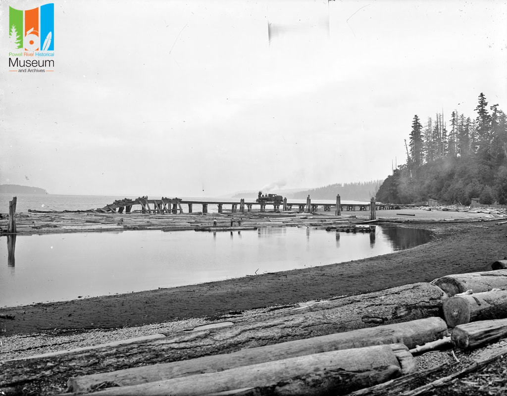
This 1920 photo shows the log dump and booming ground when it was called Michigan Landing.
Read more at the Willingdon Beach entry on the Museum placenames website
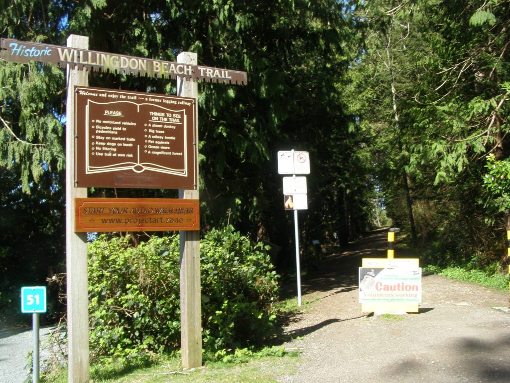
The start of the historic Willingdon Beach Trail is located a five minute walk north of the Forestry Museum.
Just follow the beach through the campground until you come to this sign and a yellow gate by the creek.
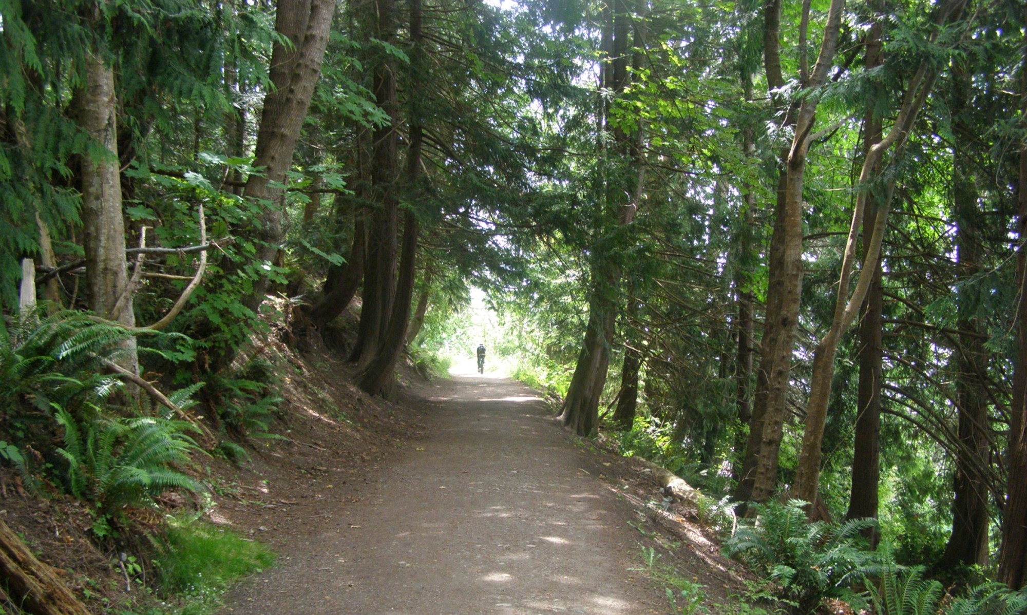
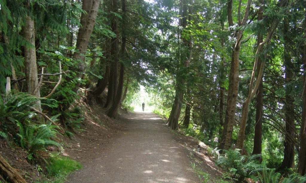
The trail is approx. 1.2 km in length and takes about 20 minutes to walk each way through a forest of towering trees and along a beautiful oceanfront.
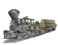
The trail originated as a logging railway. Up to 1910, the Michigan-Puget Sound Logging Company railway dumped its logs at the site of the pulp and paper mill in the Townsite. When construction of the mill started in 1910, the railway grade was extended to a new dumpsite known as Michigan’s Landing.
When logging ended in 1918, the rails remained for about eight years, then Bill Fishleigh persuaded the Powell River Company to remove the ties so that the trail could be made into a cycle path. For 15 years, he kept the trail in shape without any remuneration because he liked to do it!
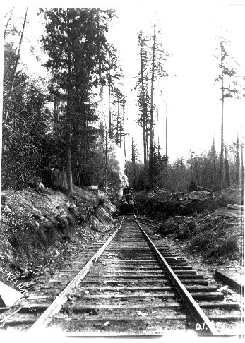
On July 1, 1928, Michigan’s Landing was officially renamed Willingdon Beach after Lord Willingdon, the Governor-General of Canada who came to Powell River and opened the park. The railway grade became known as the Willingdon Beach Trail.
For many years before a road was built, this trail was the main access route to and from the mill for workers living in Westview. It is still used for this purpose today.
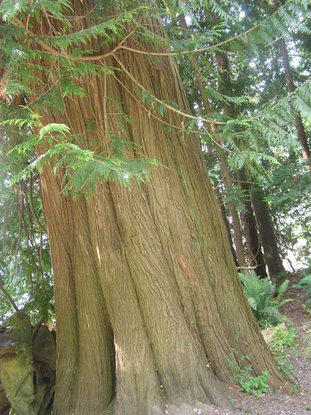
As you walk along the trail, you are surrounded by a forest of majestic beauty, containing many different tree species, such as Broadleaf Maple, Red Alder, Douglas Fir, Grand Fir, and Western Red Cedar.
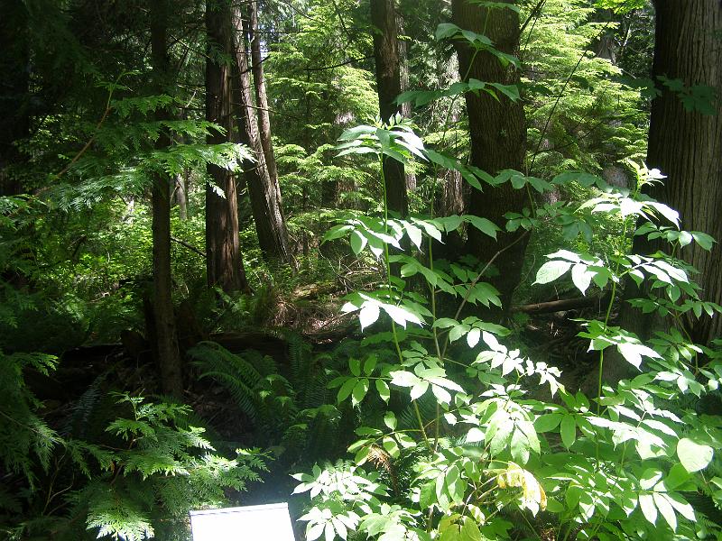
Some old-growth trees survived the early logging and forest fires, and are a reminder of the great trees of our original forests.
Several of the trees and other vegetation have interpretation signs to help you identify them.
Several series of photos of the trail can be found here in the legacy site photo album
.
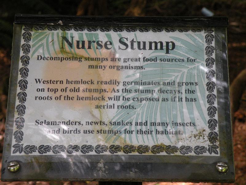
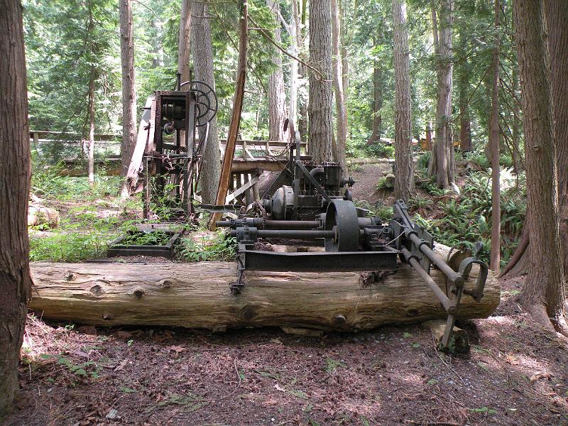
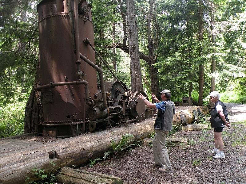
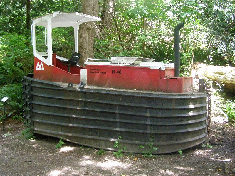
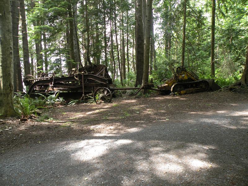
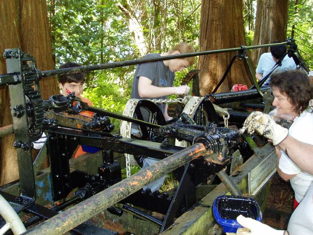
You will also see a number of logging artifacts displayed along the trail, donated by individuals or businesses from 1985 to 2010. They are now an integral part of Millennium Park and are maintained by the city.
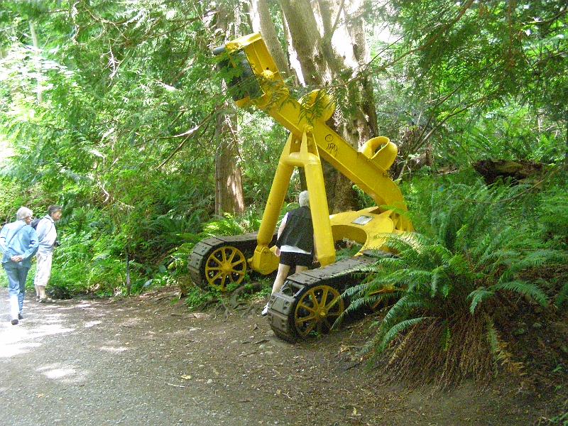
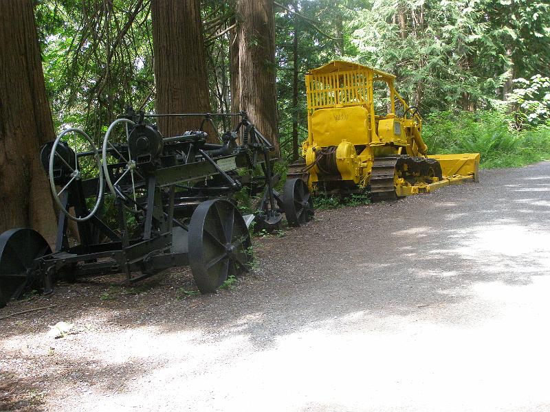
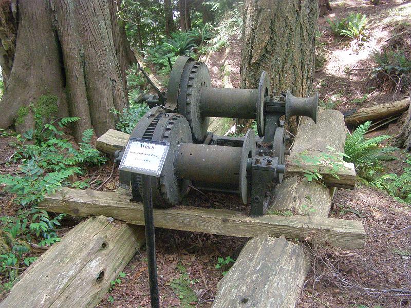
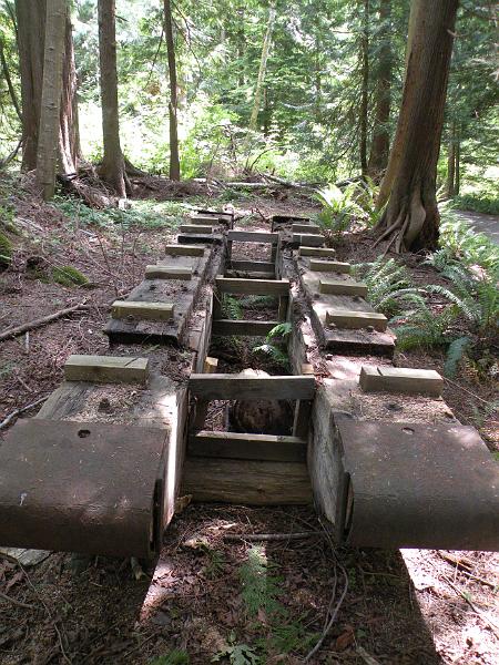
Along the trail, you can also find historical evidence of the Tla’amin Nation’s life on the coast: shell middens, culturally modified trees, and remains of an intertidal fish trap.
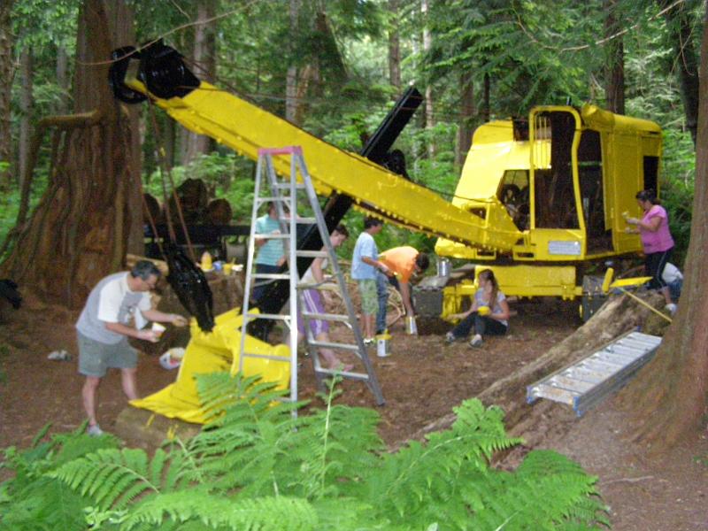
The trail requires regular maintenance. For years, the scout troop did the painting. From 1985 until 2010, volunteers from the Forestry Heritage Society felled and cleaned up danger-trees, kept the ditches clear, chipped the windfall branches, emptied the trash bins, added artifacts and signs; and raked the leaves. When the trail was purchased by the City in 2010, the City began to take over the trail maintenance from the PRFHS. When the city began the Sewar project in November 2021, running a pipe down the center of the trial, the PRFHS had to stop its work on the trail and formally turned over all trail activity to the City in September 2022.
Some videos of the trail: a Shaw cable clip about the trail; and an installation of a large Block.